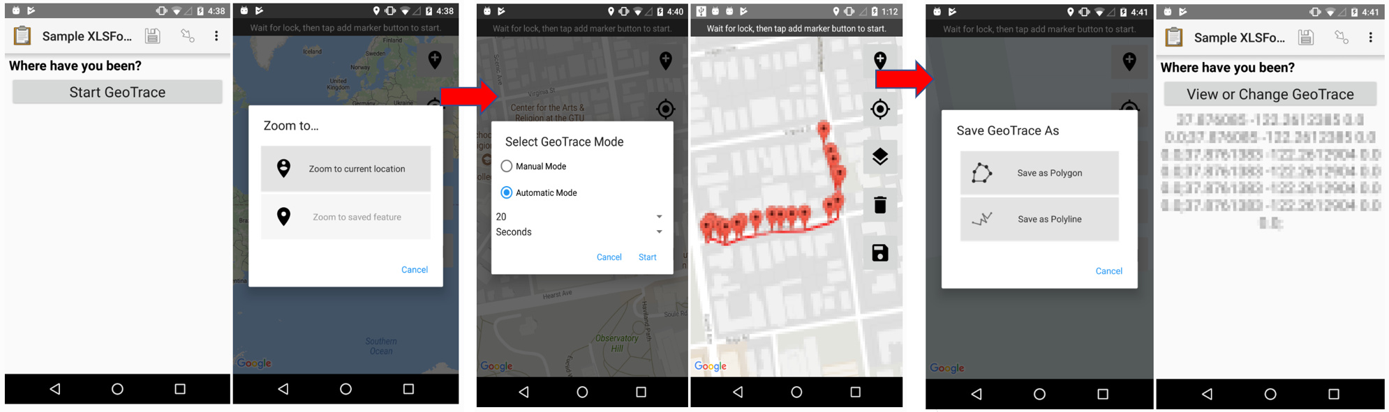
I need your support for clarification and add-in. I would like to know how to save location as polygone or polyline using location feature. For example on this picture you can see an exemple of this feature on ODK.
Thank you for posting this feature request! We are currently evaluating a geospatial widget to possibly provide as an added feature in CommCare.
Do you mind sharing more details about your use case, such as: what do you intend to use the calculated areas for? Where is your project located? What connectivity and conditions will it be used in?
Also if you have interest in participating in our beta group for this widget, please let us know.
Thanks for your answer. This is a good news.
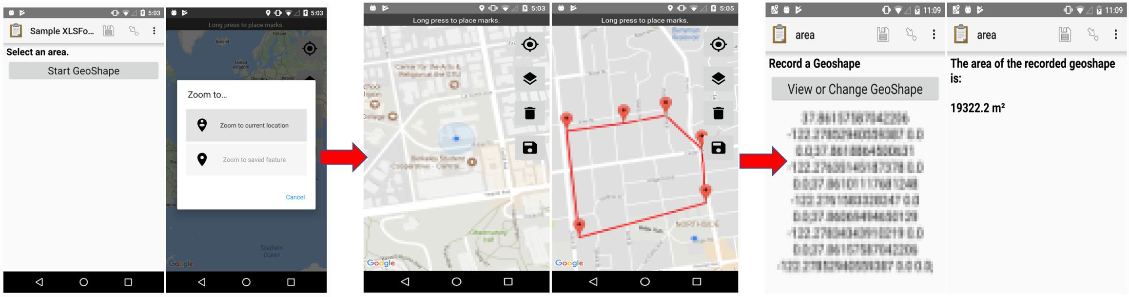
In my case, I plan using this feature to calculate are of our demonstrations plots and market gardening. I would like to do it directly with CommCare instead of using an GPS receiver to do it.
My project is located in Mali (West Africa Country).
For connectivity, Data should be collected offline because some of area of intervention are not covered by network. So our field agent will collect offline and then sync when they have accessed to network or wifi connexion.
Yes, I'm interested to be part of the beta group for this widget.
Thanks for your patience on this one. We've had delays in the start of development, but it is still on the roadmap for the coming quarter. We will keep you updated on any release dates!
In the meantime, here are a few articles that might provide helpful solutions if you need something more immediate:
Hi, just checking in on this to see if any development was done. I've looked in the documentation and everywhere else I could think of but couldn't find anything to indicate whether Commcare now has the capability save polygons and/or polylines in a way that's useable in GIS software.
I need this feature for a similar use case as Aliou, and merely calculating the size of the area isn't enough, I would like to know the location of the polygon or polyline as well.
It is possible to use the Dimagi's area mapping application to capture the coordinates of the polygon captured by the user. I realise our documentation was not updated to reflect the same. I have added information on how to set this up in CommCare over here. Let me know if you face any issues with it.